40 centuries of history

The Pont de Gard site is largely known for its Roman aqueduct, but it actually has a much more ancient history. Archaeology can take us back in time to discover its prehistoric past.
Built around 50 CE, during the reigns of the emperors Claudius and Nero, the aqueduct of which the Pont du Gard is a part, supplied the city of Nîmes with large quantities of pressurised water for over five centuries. The Roman city, known as "Nemausus” at the time, was undergoing significant urban development during the 1st century that the construction of an aqueduct was decided, in keeping with the example of Rome, as capital and model for the entire Roman Empire. This achievement gave the city (which had a population of 20,000 at the time) a high degree of prestige: fountains, spa, running water in the residences of the wealthy, and clean streets all contributed to a sense of urban well-being. With an average descent of 25 cm per kilometre, one of the lowest ever achieved at the time, the aqueduct gravity fed 30,000 to 40,000 cubic metres of fresh water from springs located in Uzès to Nîmes, thus covering a distance of 50 kilometres.

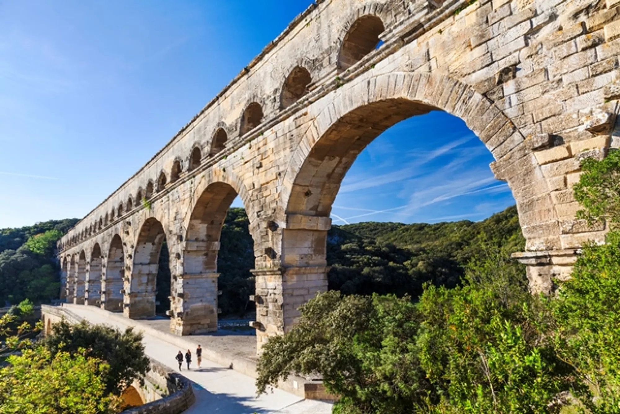
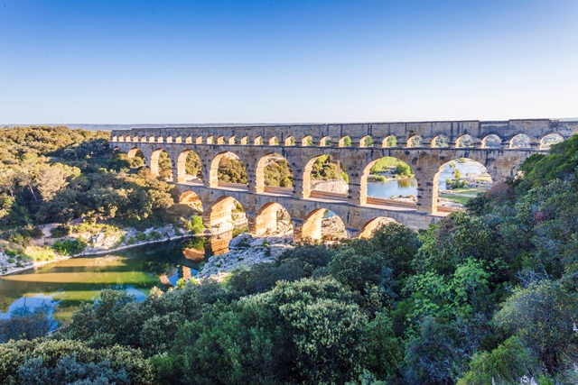
The Pont du Gard is exceptional for its dimensions, at 49 metres tall it is the highest Roman aqueduct bridge in the world.
It is the only example of an ancient three tier bridge still standing today. Nearly a thousand strong workforce contributed to the construction of this colossal project, which was completed in just five years.
Centuries of use
At the beginning of the 6th century, when the region was dominated by the Franks and the Visigoths, the Pont du Gard was finally abandoned and its structures came to be used as quarries for building materials. From the Middle Ages onwards the monument fulfilled many different functions with little to do with its original design it a source of inspiration for many Renaissance artists.
The first twelve arches of the third tier were removed to build several churches and other local buildings. The wider and more dangerous upper passage of the bridge was blocked off.
This is when the Pont du Gard is first referred to, as the "Pons de Gartio". This was in a document dated 1295, which concerned a toll that the King of France, Philippe le Bel, ceded to the Lord of Uzès in exchange for the barony of Lunel.
At the time, the road to Beaucaire and its famous fair passed by the Pont du Gard. Traffic increased rapidly, so a better passage for carts and animals was needed on the middle tier of the monument. Access ramps were built and the piers of the second tier were narrowed further (west side). But all this development was a real danger for the structure, which could easily have collapsed.
It should also be noted that the builders of the Pont d'Avignon and the Pont-Saint-Esprit were greatly inspired by the Pont du Gard.
Winter 1429-1430: following the flooding of the Gardon during the winter, King Charles VII is said to have ordered the States of Languedoc "to work without delay to repair this extremely damaged building.” This is the first sign of an awareness of the need to conserve the monument.
In 1565: Charles de l'Ecluse's map is published and is the oldest official document mentioning the Pont du Gard, as: “a magnificent bridge, built by the Romans and previously used as an aqueduct. “
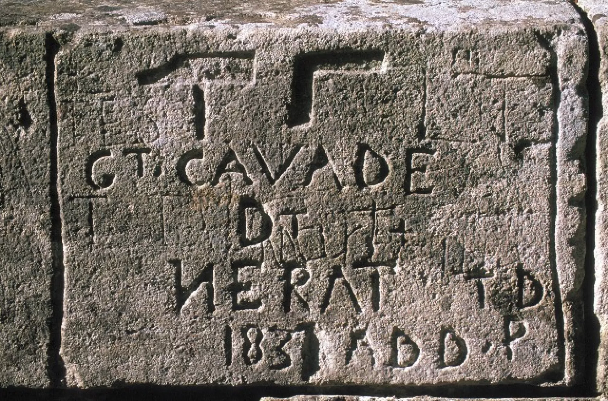
It was customary for the Companions of the Tour de France to come and pay homage to this feat of Roman architecture. To leave a trace of their passage, they engraved their insignia and tools.
It is worth noting that more than 320 such insignia have been found on the structure. The oldest dates back to 1611 and the most recent to 1989. Today, no one is allowed to engrave their name on the structure.
From 1696 to 1702: major restoration work was carried out, under the direction of the architects Daviler and de Laurens, to repair the damage caused by the movement of carts and the narrowing of the piers: which were reinforced. Awareness of the need to preserve the Pont du Gard was growing and the great architects of the time began to take deeper interest.
Between 1743 and 1747: the States of Languedoc ordered the construction of a road bridge next to the aqueduct bridge. Henri Pitot (Pitot tube and Montpellier aqueduct) was the engineer put in charge of this project. On this occasion, the Estel quarry was reopened for the purposes of this large-scale project.
Discover or download the story of Henri Pitot: the man, the engineer and his inventions (1695-1771) by Michel Desbordes, professor at Polytech'Montpellier and Michel Lescure, director of the Modernisation and Development of the Road Network, Conseil Général du Gard.
In 1840: Prosper Mérimée, the first inspector of Historic Monuments, remarked on the sad state of the Pont du Gard: “The great arches are in a dreadful state, a number of keystones have fallen away and all have somewhat degraded enough to give rise to great concern. This writer believes that this is a matter that should be dealt with without delay, as it would be impossible to forgive the administration if an accident were to occur. “
Mérimée had the Pont du Gard included in the first list of Historic Monuments. A step forward that ensured a certain acceleration in the preservation of the Pont du Gard.
Between 1842 and 1846 two restoration campaigns were completed to bring the monument out of its state of decay. As architect in charge of the monuments of Nîmes and the Pont du Gard, Charles Questel took this on. A spiral staircase was built at this time.
Between 1844 and 1845: engineers considered reusing the aqueduct to supply water to Nîmes and its textile industries.
From 1936 onwards the impact of tourism accelerates. The passage of vehicles over the road bridge causes vibrations that threaten the structure with collapse. To avoid this disaster, 310 tonnes of cement are injected into the more sensitive areas.
In 1959: a campsite is built on the right bank and marking the beginning of a form of exploitation that had little respect for the monument and its environment.
In 1985: the Pont du Gard is listed as a UNESCO World Heritage Site, and the project for a cultural facility on the site is first considered.
From 1986 onwards: the Council carries out site development surveys. A defence committee is formed.
In 1988: a scientific committee is set up. This is intended to provide guidance to development project designers.
In 1998: the Pont du Gard development project was adopted (Declaration of Public Utility), putting an end to the anarchic exploitation and degradation of the site.
In 2000: the site is opened to the public, the exhibition spaces are opened in 2001.
In 2003: the Pont du Gard became an EPCC (Etablissement Public de Coopération Culturelle).
In 2004: the Pont du Gard was awarded the Grand Site de France label. This guarantees a certain preservation and enhancement of the ancient monument and its natural environment.
In 2015: the EPCC adopts a five-year restoration plan to protect the remains of the aqueduct.
With 1,500,000 visitors, it is the most visited ancient French monument.
1985 marked the year in which the Pont du Gard was officially listed as a Unesco World Heritage Site. Although this designation testifies to the exceptional universal value of the monument, the Gard Department, anticipating a new and significant influx of tourists, decided to protect and develop the Gard department’s most visited cultural and tourist site.


